 vesseltracker.com
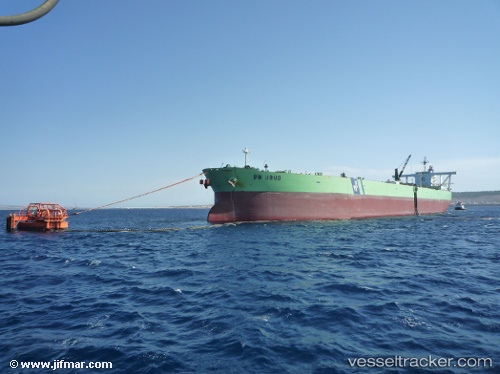
Vessel Humanity IMO: 9180281, MMSI: 422204700 Crude Oil Tanker
UTC, 2.94100, 100.89341, course: -1, speed: 12.6
UTC, 2.94100, 100.89341, course: -1, speed: 12.6
2026-03-03 23:31:25 UTC, 2.94100, 100.89341, course: -1, speed: 12.6
Live Vessel Humanity Analytics (details, animations, etc.)
Live AIS position: UTC. 24 nm W of Westport/Port Klang), updated 2026-03-03 23:31:25 UTC.Find the position of the vessel Humanity on the map. The latter are known coordinates and path.
marine traffic ship tracker show on live map
The current position of vessel Humanity is 2.94100 lat / 100.89341 lng. Updated: 2026-03-03 23:31:25 UTCDetails:
Last coordinates of the vessel:
UTC, 2.75826, 101.13075, course: 300, speed: 11.1UTC, 2.94100, 100.89341, course: -1, speed: 12.6
UTC, 2.94100, 100.89341, course: -1, speed: 12.6
2026-03-03 23:31:25 UTC, 2.94100, 100.89341, course: -1, speed: 12.6