 vesseltracker.com
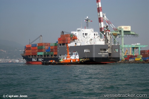
Vessel Pacific Islander 2 IMO: 9255921, MMSI: 431011000 General Cargo Ship
UTC, 34.26989, 140.03519, course: 160, speed: 11.8
UTC, 32.75851, 140.94907, course: 157, speed: 11
2026-03-05 01:59:48 UTC, 32.34594, 141.17508, course: 157, speed: 11.2
Live Vessel Pacific Islander 2 Analytics (details, animations, etc.)
Live AIS position: UTC. 162 nm SE of Toshima/Tokyo), updated 2026-03-05 01:59:48 UTC.Find the position of the vessel Pacific Islander 2 on the map. The latter are known coordinates and path.
marine traffic ship tracker show on live map
The current position of vessel Pacific Islander 2 is 32.34594 lat / 141.17508 lng. Updated: 2026-03-05 01:59:48 UTCCurrently sailing under the flag of Japan
Pacific Islander 2 built in 2003 year
Deadweight:
17916 tDetails:
Last coordinates of the vessel:
UTC, 34.26989, 140.03519, course: 160, speed: 11.8UTC, 34.26989, 140.03519, course: 160, speed: 11.8
UTC, 32.75851, 140.94907, course: 157, speed: 11
2026-03-05 01:59:48 UTC, 32.34594, 141.17508, course: 157, speed: 11.2