 vesseltracker.com
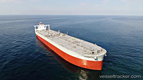
Vessel KISOGAWA IMO: 9805087, MMSI: 431114000 Crude Oil Tanker
UTC, 2.60023, 104.96932, course: 102, speed: 0.9
UTC, 2.57332, 104.97009, course: 97, speed: 0.9
2026-03-05 01:43:56 UTC, 2.54438, 104.97599, course: 98, speed: 0.9
Live Vessel KISOGAWA Analytics (details, animations, etc.)
Live AIS position: UTC. 84 nm E of Kampung Jawa), updated 2026-03-05 01:43:56 UTC.Find the position of the vessel KISOGAWA on the map. The latter are known coordinates and path.
marine traffic ship tracker show on live map
The current position of vessel KISOGAWA is 2.54438 lat / 104.97599 lng. Updated: 2026-03-05 01:43:56 UTCCurrently sailing under the flag of Japan
KISOGAWA built in 2017 year
Deadweight:
311831 tDetails:
Last coordinates of the vessel:
UTC, 2.63108, 104.96474, course: 98, speed: 1UTC, 2.60023, 104.96932, course: 102, speed: 0.9
UTC, 2.57332, 104.97009, course: 97, speed: 0.9
2026-03-05 01:43:56 UTC, 2.54438, 104.97599, course: 98, speed: 0.9