 vesseltracker.com
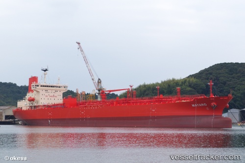
Vessel Mayaro IMO: 9733703, MMSI: 431228000 Chemical Oil Products Tanker
UTC, 48.22440, -60.93442, course: 297, speed: 10.3
UTC, 48.39919, -61.40467, course: 306, speed: 9.4
2026-03-05 03:35:47 UTC, 48.54859, -61.82066, course: 303, speed: 8.6
Live Vessel Mayaro Analytics (details, animations, etc.)
Live AIS position: UTC. 70 nm N of Cap-aux-Meules), updated 2026-03-05 03:35:47 UTC.Find the position of the vessel Mayaro on the map. The latter are known coordinates and path.
marine traffic ship tracker show on live map
The current position of vessel Mayaro is 48.54859 lat / -61.82066 lng. Updated: 2026-03-05 03:35:47 UTCDetails:
Last coordinates of the vessel:
UTC, 47.12019, -59.72041, course: 309, speed: 11.9UTC, 48.22440, -60.93442, course: 297, speed: 10.3
UTC, 48.39919, -61.40467, course: 306, speed: 9.4
2026-03-05 03:35:47 UTC, 48.54859, -61.82066, course: 303, speed: 8.6