 vesseltracker.com
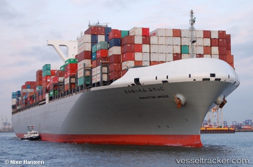
Vessel Manhattan Bridge IMO: 9689615, MMSI: 431260000 Container Ship
UTC, 13.05045, 100.89894, course: 253, speed: 0
UTC, 13.05046, 100.89897, course: 253, speed: 0
2026-03-04 19:46:14 UTC, 13.05049, 100.89901, course: 253, speed: 0.1
Live Vessel Manhattan Bridge Analytics (details, animations, etc.)
Live AIS position: UTC. Near Tips Container Terminal), updated 2026-03-04 19:46:14 UTC.Find the position of the vessel Manhattan Bridge on the map. The latter are known coordinates and path.
marine traffic ship tracker show on live map
The current position of vessel Manhattan Bridge is 13.05049 lat / 100.89901 lng. Updated: 2026-03-04 19:46:14 UTCCurrently sailing under the flag of Japan
Details:
Last coordinates of the vessel:
UTC, 13.05048, 100.89900, course: 253, speed: 0UTC, 13.05045, 100.89894, course: 253, speed: 0
UTC, 13.05046, 100.89897, course: 253, speed: 0
2026-03-04 19:46:14 UTC, 13.05049, 100.89901, course: 253, speed: 0.1