 vesseltracker.com
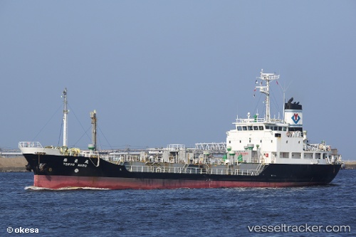
Vessel Toryo Maru IMO: 9115107, MMSI: 431697000 Chemical Tanker
UTC, -17.52733, 153.28795, course: -1, speed: 9.8
UTC, -17.52733, 153.28795, course: -1, speed: 9.8
2026-03-04 23:41:36 UTC, -16.60398, 153.09309, course: 356, speed: 9.2
Live Vessel Toryo Maru Analytics (details, animations, etc.)
Live AIS position: UTC. 195 nm NE of Coral Sea), updated 2026-03-04 23:41:36 UTC.Find the position of the vessel Toryo Maru on the map. The latter are known coordinates and path.
marine traffic ship tracker show on live map
The current position of vessel Toryo Maru is -16.60398 lat / 153.09309 lng. Updated: 2026-03-04 23:41:36 UTCCurrently sailing under the flag of Japan
Details:
Last coordinates of the vessel:
UTC, -17.59219, 153.30698, course: -1, speed: 9.7UTC, -17.52733, 153.28795, course: -1, speed: 9.8
UTC, -17.52733, 153.28795, course: -1, speed: 9.8
2026-03-04 23:41:36 UTC, -16.60398, 153.09309, course: 356, speed: 9.2