 vesseltracker.com
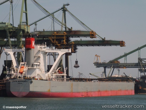
Vessel CAPE NORMANDY IMO: 9558232, MMSI: 431750000 Bulk Carrier
UTC, 12.89703, 119.39712, course: -1, speed: 11.3
UTC, 12.89703, 119.39712, course: -1, speed: 11.3
2026-03-04 23:45:37 UTC, 13.32167, 117.98833, course: -1, speed: 12
Live Vessel CAPE NORMANDY Analytics (details, animations, etc.)
Live AIS position: UTC. 126 nm NW of Malampaya), updated 2026-03-04 23:45:37 UTC.Find the position of the vessel CAPE NORMANDY on the map. The latter are known coordinates and path.
marine traffic ship tracker show on live map
The current position of vessel CAPE NORMANDY is 13.32167 lat / 117.98833 lng. Updated: 2026-03-04 23:45:37 UTCCurrently sailing under the flag of Japan
CAPE NORMANDY built in 2012 year
Deadweight:
180646 tDetails:
Last coordinates of the vessel:
UTC, 12.89703, 119.39712, course: -1, speed: 11.3UTC, 12.89703, 119.39712, course: -1, speed: 11.3
UTC, 12.89703, 119.39712, course: -1, speed: 11.3
2026-03-04 23:45:37 UTC, 13.32167, 117.98833, course: -1, speed: 12