 vesseltracker.com
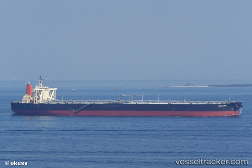
Vessel HAKUSAN IMO: 9535058, MMSI: 431938000 Crude Oil Tanker
UTC, 5.50537, 106.90285, course: -1, speed: 17.2
UTC, 5.08653, 106.51332, course: -1, speed: 17.3
2026-03-05 03:53:39 UTC, 4.69322, 106.04434, course: 225, speed: 15.7
Live Vessel HAKUSAN Analytics (details, animations, etc.)
Live AIS position: UTC. 20 nm S of Kakap Natuna Terminal), updated 2026-03-05 03:53:39 UTC.Find the position of the vessel HAKUSAN on the map. The latter are known coordinates and path.
marine traffic ship tracker show on live map
The current position of vessel HAKUSAN is 4.69322 lat / 106.04434 lng. Updated: 2026-03-05 03:53:39 UTCCurrently sailing under the flag of Japan
HAKUSAN built in 2011 year
Deadweight:
305350 tDetails:
Last coordinates of the vessel:
UTC, 5.82079, 107.30724, course: 233, speed: 17.2UTC, 5.50537, 106.90285, course: -1, speed: 17.2
UTC, 5.08653, 106.51332, course: -1, speed: 17.3
2026-03-05 03:53:39 UTC, 4.69322, 106.04434, course: 225, speed: 15.7