 vesseltracker.com
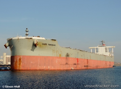
Vessel Cape Yamabuki IMO: 9482225, MMSI: 432752000 Bulk Carrier
UTC, 39.00056, 118.45523, course: 359, speed: 0
UTC, 39.00061, 118.45525, course: 359, speed: 0
2026-03-04 17:39:56 UTC, 39.00061, 118.45526, course: 0, speed: 0
Live Vessel Cape Yamabuki Analytics (details, animations, etc.)
Live AIS position: UTC. Near Caofeidian Pt), updated 2026-03-04 17:39:56 UTC.Find the position of the vessel Cape Yamabuki on the map. The latter are known coordinates and path.
marine traffic ship tracker show on live map
The current position of vessel Cape Yamabuki is 39.00061 lat / 118.45526 lng. Updated: 2026-03-04 17:39:56 UTCCurrently sailing under the flag of Japan
Cape Yamabuki built in 2010 year
Deadweight:
182534 tDetails:
Last coordinates of the vessel:
UTC, 39.00059, 118.45525, course: 0, speed: 0UTC, 39.00056, 118.45523, course: 359, speed: 0
UTC, 39.00061, 118.45525, course: 359, speed: 0
2026-03-04 17:39:56 UTC, 39.00061, 118.45526, course: 0, speed: 0