 vesseltracker.com
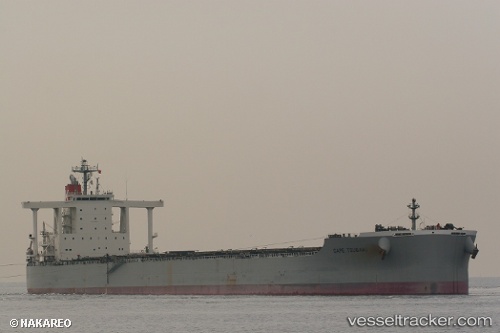
Vessel Cape Tsubaki IMO: 9482249, MMSI: 432767000 Bulk Carrier
UTC, -25.20667, -33.35833, course: -1, speed: 13
UTC, -25.20667, -33.35833, course: -1, speed: 13
2026-03-04 15:52:50 UTC, -25.20667, -33.35833, course: -1, speed: 13
Live Vessel Cape Tsubaki Analytics (details, animations, etc.)
Live AIS position: UTC. 205 nm SE of Bela Vista), updated 2026-03-04 15:52:50 UTC.Find the position of the vessel Cape Tsubaki on the map. The latter are known coordinates and path.
marine traffic ship tracker show on live map
The current position of vessel Cape Tsubaki is -25.20667 lat / -33.35833 lng. Updated: 2026-03-04 15:52:50 UTCCurrently sailing under the flag of Japan
Cape Tsubaki built in 2010 year
Deadweight:
182718 tDetails:
Last coordinates of the vessel:
UTC, -25.28466, -32.96154, course: 280, speed: 13.3UTC, -25.20667, -33.35833, course: -1, speed: 13
UTC, -25.20667, -33.35833, course: -1, speed: 13
2026-03-04 15:52:50 UTC, -25.20667, -33.35833, course: -1, speed: 13