 vesseltracker.com
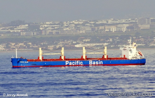
Vessel Chiloe Island IMO: 9610755, MMSI: 477752900 Bulk Carrier
UTC, 40.24324, 121.74629, course: 33, speed: 0.1
UTC, 40.24325, 121.74640, course: 28, speed: 0.2
2026-03-05 02:10:10 UTC, 40.24321, 121.74626, course: 38, speed: 0.1
Live Vessel Chiloe Island Analytics (details, animations, etc.)
Live AIS position: UTC. 17 nm W of Bayuquan), updated 2026-03-05 02:10:10 UTC.Find the position of the vessel Chiloe Island on the map. The latter are known coordinates and path.
marine traffic ship tracker show on live map
The current position of vessel Chiloe Island is 40.24321 lat / 121.74626 lng. Updated: 2026-03-05 02:10:10 UTCDetails:
Last coordinates of the vessel:
UTC, 40.24333, 121.74615, course: 46, speed: 0UTC, 40.24324, 121.74629, course: 33, speed: 0.1
UTC, 40.24325, 121.74640, course: 28, speed: 0.2
2026-03-05 02:10:10 UTC, 40.24321, 121.74626, course: 38, speed: 0.1