 vesseltracker.com
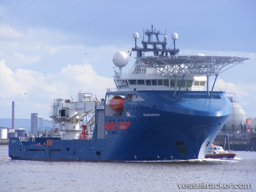
Vessel OCEAN PROTECTOR IMO: 9374260, MMSI: 503798000 Offshore Supply Ship
UTC, -32.22838, 115.69804, course: 312, speed: 0
UTC, -32.22840, 115.69806, course: 311, speed: 0
2026-02-24 13:23:07 UTC, -32.22839, 115.69806, course: 311, speed: 0
Live AIS position:
UTC. Near Kwinana),
updated 2026-02-24 13:23:07 UTC.
Find the position of the vessel OCEAN PROTECTOR on the map. The latter are known coordinates and path.
marine traffic ship tracker show on live map
The current position of vessel OCEAN PROTECTOR is -32.22839 lat / 115.69806 lng. Updated: 2026-02-24 13:23:07 UTCCurrently sailing under the flag of Australia
Details:
Last coordinates of the vessel:
UTC, -32.22842, 115.69807, course: 312, speed: 0UTC, -32.22838, 115.69804, course: 312, speed: 0
UTC, -32.22840, 115.69806, course: 311, speed: 0
2026-02-24 13:23:07 UTC, -32.22839, 115.69806, course: 311, speed: 0