 vesseltracker.com
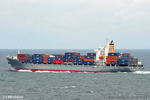
Vessel Oriental Galaxy IMO: 9120920, MMSI: 525003624 Container Ship
UTC, -1.50718, 129.64876, course: -1, speed: 12
UTC, -1.50718, 129.64876, course: -1, speed: 12
2026-03-04 17:42:16 UTC, -1.50718, 129.64876, course: -1, speed: 12
Live Vessel Oriental Galaxy Analytics (details, animations, etc.)
Live AIS position: UTC. 52 nm W of Misool Terminal), updated 2026-03-04 17:42:16 UTC.Find the position of the vessel Oriental Galaxy on the map. The latter are known coordinates and path.
marine traffic ship tracker show on live map
The current position of vessel Oriental Galaxy is -1.50718 lat / 129.64876 lng. Updated: 2026-03-04 17:42:16 UTCCurrently sailing under the flag of Indonesia
Oriental Galaxy built in 1996 year
Deadweight:
23650 tDetails:
Last coordinates of the vessel:
UTC, -1.31332, 129.91420, course: -1, speed: 11.5UTC, -1.50718, 129.64876, course: -1, speed: 12
UTC, -1.50718, 129.64876, course: -1, speed: 12
2026-03-04 17:42:16 UTC, -1.50718, 129.64876, course: -1, speed: 12