 vesseltracker.com
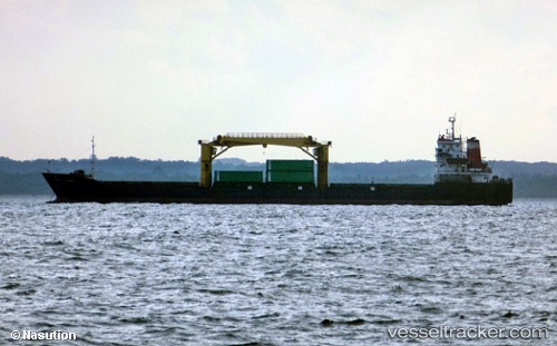
Vessel Pulau Layang IMO: 9545754, MMSI: 525015347 General Cargo Ship
UTC, -6.88496, 112.79807, course: -1, speed: 0.2
UTC, -6.88496, 112.79807, course: -1, speed: 0.2
2026-03-03 21:29:49 UTC, -6.88496, 112.79807, course: -1, speed: 0.2
Live Vessel Pulau Layang Analytics (details, animations, etc.)
Live AIS position: UTC. Near Bangkalan), updated 2026-03-03 21:29:49 UTC.Find the position of the vessel Pulau Layang on the map. The latter are known coordinates and path.
marine traffic ship tracker show on live map
The current position of vessel Pulau Layang is -6.88496 lat / 112.79807 lng. Updated: 2026-03-03 21:29:49 UTCDetails:
Last coordinates of the vessel:
UTC, -6.88530, 112.79796, course: -1, speed: 0.1UTC, -6.88496, 112.79807, course: -1, speed: 0.2
UTC, -6.88496, 112.79807, course: -1, speed: 0.2
2026-03-03 21:29:49 UTC, -6.88496, 112.79807, course: -1, speed: 0.2