 vesseltracker.com
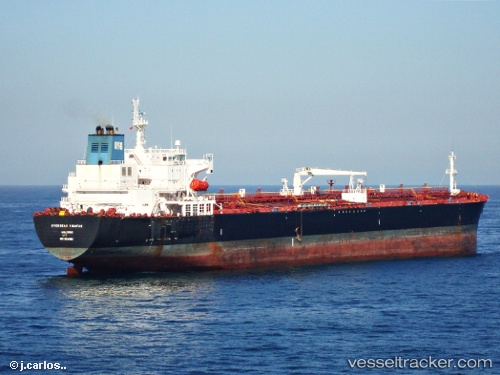
Vessel Seaways Visayas IMO: 9301952, MMSI: 538002947 Crude Oil Tanker
UTC, 36.87300, 0.12727, course: 67, speed: 12.5
UTC, 36.90567, 0.25532, course: 70, speed: 13.2
2026-03-04 22:19:05 UTC, 37.16333, 1.45667, course: -1, speed: 13
Live Vessel Seaways Visayas Analytics (details, animations, etc.)
Live AIS position: UTC. 35 nm W of Albanchez), updated 2026-03-04 22:19:05 UTC.Find the position of the vessel Seaways Visayas on the map. The latter are known coordinates and path.
marine traffic ship tracker show on live map
The current position of vessel Seaways Visayas is 37.16333 lat / 1.45667 lng. Updated: 2026-03-04 22:19:05 UTCDetails:
Last coordinates of the vessel:
UTC, 36.75689, -0.27416, course: 72, speed: 11.7UTC, 36.87300, 0.12727, course: 67, speed: 12.5
UTC, 36.90567, 0.25532, course: 70, speed: 13.2
2026-03-04 22:19:05 UTC, 37.16333, 1.45667, course: -1, speed: 13