 vesseltracker.com
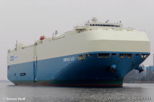
Vessel Emerald Ace IMO: 9539236, MMSI: 538004697 Vehicles Carrier
UTC, 29.72325, 129.06821, course: 148, speed: 18.3
UTC, 29.31729, 129.45293, course: 136, speed: 17.5
2026-03-04 19:37:46 UTC, 29.31729, 129.45293, course: 136, speed: 17.5
Live Vessel Emerald Ace Analytics (details, animations, etc.)
Live AIS position: UTC. 66 nm NW of Kikaishima), updated 2026-03-04 19:37:46 UTC.Find the position of the vessel Emerald Ace on the map. The latter are known coordinates and path.
marine traffic ship tracker show on live map
The current position of vessel Emerald Ace is 29.31729 lat / 129.45293 lng. Updated: 2026-03-04 19:37:46 UTCDetails:
Last coordinates of the vessel:
UTC, 30.49518, 128.31642, course: 140, speed: 18.5UTC, 29.72325, 129.06821, course: 148, speed: 18.3
UTC, 29.31729, 129.45293, course: 136, speed: 17.5
2026-03-04 19:37:46 UTC, 29.31729, 129.45293, course: 136, speed: 17.5