 vesseltracker.com
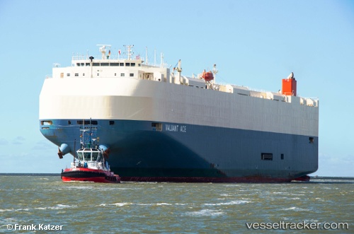
Vessel Valiant Ace IMO: 9610420, MMSI: 538004759 Vehicles Carrier
UTC, 32.96849, -151.49950, course: 76, speed: 13.6
UTC, 32.99327, -151.39012, course: 74, speed: 13.6
2026-03-04 16:05:04 UTC, 32.99327, -151.39012, course: 74, speed: 13.6
Live Vessel Valiant Ace Analytics (details, animations, etc.)
Live AIS position: UTC. 307 nm N of Vega de San Mateo), updated 2026-03-04 16:05:04 UTC.Find the position of the vessel Valiant Ace on the map. The latter are known coordinates and path.
marine traffic ship tracker show on live map
The current position of vessel Valiant Ace is 32.99327 lat / -151.39012 lng. Updated: 2026-03-04 16:05:04 UTCDetails:
Last coordinates of the vessel:
UTC, 32.87002, -151.93462, course: 77, speed: 14UTC, 32.96849, -151.49950, course: 76, speed: 13.6
UTC, 32.99327, -151.39012, course: 74, speed: 13.6
2026-03-04 16:05:04 UTC, 32.99327, -151.39012, course: 74, speed: 13.6