 vesseltracker.com
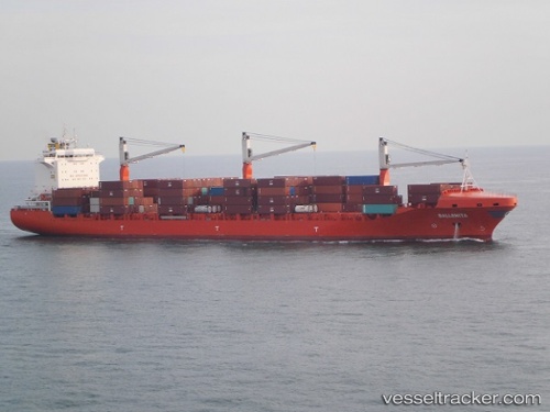
Vessel Ballenita IMO: 9603609, MMSI: 538005112 Container Ship
UTC, 7.28267, 108.58383, course: -1, speed: 14.3
UTC, 7.70567, 108.83267, course: -1, speed: 14.8
2026-03-04 23:36:53 UTC, 8.09750, 109.11517, course: -1, speed: 13.3
Live Vessel Ballenita Analytics (details, animations, etc.)
Live AIS position: UTC. 34 nm SE of Dai Hung (Tandem Load)), updated 2026-03-04 23:36:53 UTC.Find the position of the vessel Ballenita on the map. The latter are known coordinates and path.
marine traffic ship tracker show on live map
The current position of vessel Ballenita is 8.09750 lat / 109.11517 lng. Updated: 2026-03-04 23:36:53 UTCDetails:
Last coordinates of the vessel:
UTC, 6.91583, 108.31600, course: -1, speed: 14.3UTC, 7.28267, 108.58383, course: -1, speed: 14.3
UTC, 7.70567, 108.83267, course: -1, speed: 14.8
2026-03-04 23:36:53 UTC, 8.09750, 109.11517, course: -1, speed: 13.3