 vesseltracker.com
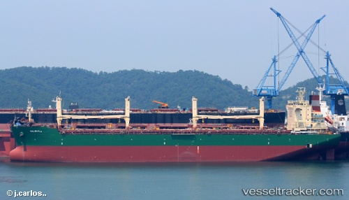
Vessel Halophyla IMO: 9613329, MMSI: 538005205 General Cargo Ship
UTC, -21.98884, 56.37114, course: 241, speed: 13.6
UTC, -21.98884, 56.37114, course: 241, speed: 13.6
2026-03-04 22:15:36 UTC, -22.42410, 55.51443, course: 246, speed: 13
Live Vessel Halophyla Analytics (details, animations, etc.)
Live AIS position: UTC. 64 nm S of Saint-Joseph), updated 2026-03-04 22:15:36 UTC.Find the position of the vessel Halophyla on the map. The latter are known coordinates and path.
marine traffic ship tracker show on live map
The current position of vessel Halophyla is -22.42410 lat / 55.51443 lng. Updated: 2026-03-04 22:15:36 UTCDetails:
Last coordinates of the vessel:
UTC, -21.72437, 56.87748, course: 241, speed: 13.2UTC, -21.98884, 56.37114, course: 241, speed: 13.6
UTC, -21.98884, 56.37114, course: 241, speed: 13.6
2026-03-04 22:15:36 UTC, -22.42410, 55.51443, course: 246, speed: 13