 vesseltracker.com
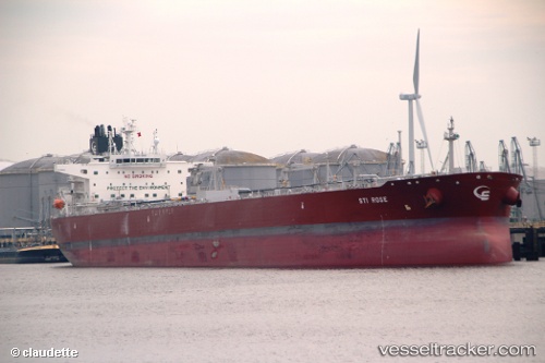
Vessel Sti Rose IMO: 9696682, MMSI: 538006037 Crude Oil Tanker
UTC, 34.35699, -49.59448, course: 250, speed: 11.1
UTC, 34.27994, -49.89331, course: 250, speed: 11.4
2026-03-05 14:15:09 UTC, 34.23496, -50.06206, course: 254, speed: 11.6
Live Vessel Sti Rose Analytics (details, animations, etc.)
Live AIS position: UTC. 139 nm S of Benahavis), updated 2026-03-05 14:15:09 UTC.Find the position of the vessel Sti Rose on the map. The latter are known coordinates and path.
marine traffic ship tracker show on live map
The current position of vessel Sti Rose is 34.23496 lat / -50.06206 lng. Updated: 2026-03-05 14:15:09 UTCCurrently sailing under the flag of Marshall Is
Details:
Last coordinates of the vessel:
UTC, 34.43397, -49.25785, course: 253, speed: 10.7UTC, 34.35699, -49.59448, course: 250, speed: 11.1
UTC, 34.27994, -49.89331, course: 250, speed: 11.4
2026-03-05 14:15:09 UTC, 34.23496, -50.06206, course: 254, speed: 11.6