 vesseltracker.com
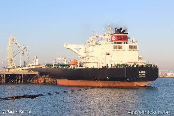
Vessel Loire IMO: 9761516, MMSI: 538006701 Crude Oil Tanker
UTC, 16.35022, -70.27863, course: 97, speed: 10.6
UTC, 15.97167, -68.98833, course: -1, speed: 11
2026-03-05 01:22:09 UTC, 15.85500, -68.59667, course: -1, speed: 10
Live Vessel Loire Analytics (details, animations, etc.)
Live AIS position: UTC. 153 nm S of Catalina Island), updated 2026-03-05 01:22:09 UTC.Find the position of the vessel Loire on the map. The latter are known coordinates and path.
marine traffic ship tracker show on live map
The current position of vessel Loire is 15.85500 lat / -68.59667 lng. Updated: 2026-03-05 01:22:09 UTCCurrently sailing under the flag of Marshall Is
Details:
Last coordinates of the vessel:
UTC, 16.35022, -70.27863, course: 97, speed: 10.6UTC, 16.35022, -70.27863, course: 97, speed: 10.6
UTC, 15.97167, -68.98833, course: -1, speed: 11
2026-03-05 01:22:09 UTC, 15.85500, -68.59667, course: -1, speed: 10