 vesseltracker.com
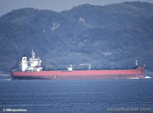
Vessel Atlantic Harmony IMO: 9797747, MMSI: 538007428 Chemical Oil Products Tanker
UTC, 21.15500, 121.55500, course: -1, speed: 11
UTC, 22.71167, 122.43833, course: -1, speed: 10
2026-03-05 02:00:33 UTC, 22.99691, 122.54407, course: -1, speed: 10.8
Live Vessel Atlantic Harmony Analytics (details, animations, etc.)
Live AIS position: UTC. 78 nm SE of Hua-Lien Kang), updated 2026-03-05 02:00:33 UTC.Find the position of the vessel Atlantic Harmony on the map. The latter are known coordinates and path.
marine traffic ship tracker show on live map
The current position of vessel Atlantic Harmony is 22.99691 lat / 122.54407 lng. Updated: 2026-03-05 02:00:33 UTCDetails:
Last coordinates of the vessel:
UTC, 21.15500, 121.55500, course: -1, speed: 11UTC, 21.15500, 121.55500, course: -1, speed: 11
UTC, 22.71167, 122.43833, course: -1, speed: 10
2026-03-05 02:00:33 UTC, 22.99691, 122.54407, course: -1, speed: 10.8