 vesseltracker.com
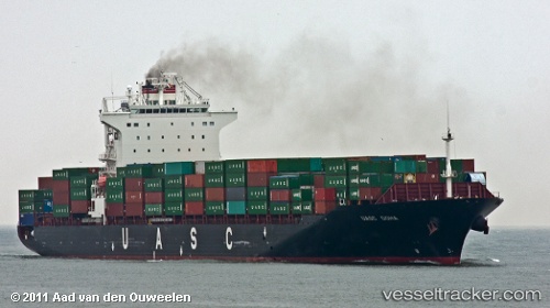
Vessel Eleni T IMO: 9397585, MMSI: 538007684 Container Ship
UTC, 16.89443, 54.40876, course: -1, speed: 12.3
UTC, 16.91500, 55.04833, course: -1, speed: 13
2026-03-04 23:30:11 UTC, 16.99000, 55.30667, course: -1, speed: 12
Live Vessel Eleni T Analytics (details, animations, etc.)
Live AIS position: UTC. 73 nm E of Mina Raysut), updated 2026-03-04 23:30:11 UTC.Find the position of the vessel Eleni T on the map. The latter are known coordinates and path.
marine traffic ship tracker show on live map
The current position of vessel Eleni T is 16.99000 lat / 55.30667 lng. Updated: 2026-03-04 23:30:11 UTCCurrently sailing under the flag of Marshall Is
Eleni T built in 2009 year
Deadweight:
50700 tDetails:
Last coordinates of the vessel:
UTC, 16.92473, 54.15217, course: -1, speed: 14.3UTC, 16.89443, 54.40876, course: -1, speed: 12.3
UTC, 16.91500, 55.04833, course: -1, speed: 13
2026-03-04 23:30:11 UTC, 16.99000, 55.30667, course: -1, speed: 12