 vesseltracker.com
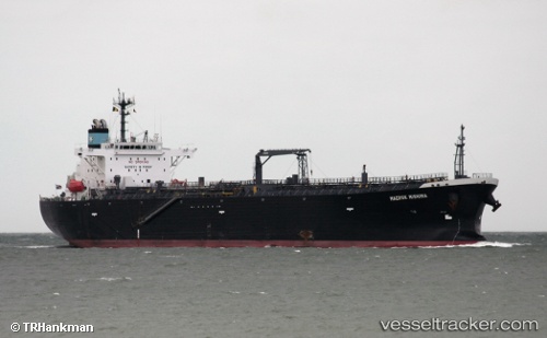
Vessel Atalanta T IMO: 9450789, MMSI: 538008124 Oil Products Tanker
UTC, -15.09833, 43.66500, course: -1, speed: 12
UTC, -15.26667, 43.45333, course: -1, speed: 13
2026-03-05 01:56:32 UTC, -15.58189, 43.00891, course: 231, speed: 12.6
Live Vessel Atalanta T Analytics (details, animations, etc.)
Live AIS position: UTC. 103 nm NW of Ankokoambo), updated 2026-03-05 01:56:32 UTC.Find the position of the vessel Atalanta T on the map. The latter are known coordinates and path.
marine traffic ship tracker show on live map
The current position of vessel Atalanta T is -15.58189 lat / 43.00891 lng. Updated: 2026-03-05 01:56:32 UTCDetails:
Last coordinates of the vessel:
UTC, -14.41092, 44.62085, course: 236, speed: 12.7UTC, -15.09833, 43.66500, course: -1, speed: 12
UTC, -15.26667, 43.45333, course: -1, speed: 13
2026-03-05 01:56:32 UTC, -15.58189, 43.00891, course: 231, speed: 12.6