 vesseltracker.com
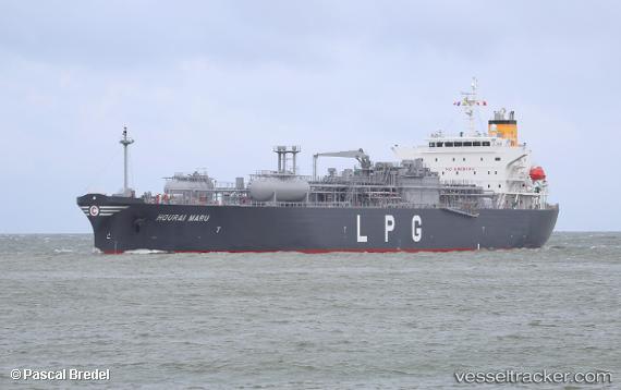
Vessel Hourai Maru IMO: 9796585, MMSI: 538008262 Lpg Tanker
UTC, 49.76918, -5.46817, course: 99, speed: 16.4
UTC, 49.73486, -4.94790, course: 88, speed: 15.6
2026-03-04 22:06:39 UTC, 49.74292, -4.04533, course: 88, speed: 14.1
Live Vessel Hourai Maru Analytics (details, animations, etc.)
Live AIS position: UTC. 19 nm S of Cornwall), updated 2026-03-04 22:06:39 UTC.Find the position of the vessel Hourai Maru on the map. The latter are known coordinates and path.
marine traffic ship tracker show on live map
The current position of vessel Hourai Maru is 49.74292 lat / -4.04533 lng. Updated: 2026-03-04 22:06:39 UTCDetails:
Last coordinates of the vessel:
UTC, 50.21634, -6.01825, course: 185, speed: 13.3UTC, 49.76918, -5.46817, course: 99, speed: 16.4
UTC, 49.73486, -4.94790, course: 88, speed: 15.6
2026-03-04 22:06:39 UTC, 49.74292, -4.04533, course: 88, speed: 14.1