 vesseltracker.com
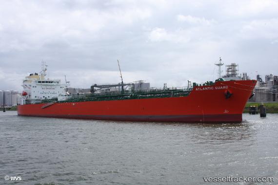
Vessel Atlantic Guard IMO: 9789269, MMSI: 538008368 Chemical Oil Products Tanker
UTC, 11.84603, -79.76176, course: 184, speed: 11.9
UTC, 11.74339, -79.77173, course: 177, speed: 12
2026-03-04 16:54:30 UTC, 11.74339, -79.77173, course: 177, speed: 12
Live Vessel Atlantic Guard Analytics (details, animations, etc.)
Live AIS position: UTC. 124 nm SE of San Andrés), updated 2026-03-04 16:54:30 UTC.Find the position of the vessel Atlantic Guard on the map. The latter are known coordinates and path.
marine traffic ship tracker show on live map
The current position of vessel Atlantic Guard is 11.74339 lat / -79.77173 lng. Updated: 2026-03-04 16:54:30 UTCDetails:
Last coordinates of the vessel:
UTC, 12.37167, -79.71833, course: -1, speed: 11UTC, 11.84603, -79.76176, course: 184, speed: 11.9
UTC, 11.74339, -79.77173, course: 177, speed: 12
2026-03-04 16:54:30 UTC, 11.74339, -79.77173, course: 177, speed: 12