 vesseltracker.com
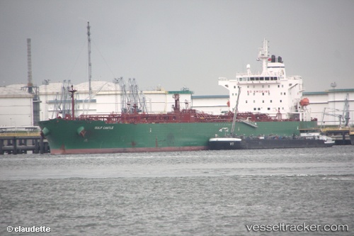
Vessel SEAWAYS GUAYAQUIL IMO: 9389837, MMSI: 538008861 Crude Oil Tanker
UTC, -5.74608, -81.01405, course: 12, speed: 0
UTC, -5.74613, -81.01463, course: 24, speed: 0
2026-03-04 23:51:23 UTC, -5.74623, -81.01357, course: 345, speed: 0.1
Live Vessel SEAWAYS GUAYAQUIL Analytics (details, animations, etc.)
Live AIS position: UTC. Near Bayovar), updated 2026-03-04 23:51:23 UTC.Find the position of the vessel SEAWAYS GUAYAQUIL on the map. The latter are known coordinates and path.
marine traffic ship tracker show on live map
The current position of vessel SEAWAYS GUAYAQUIL is -5.74623 lat / -81.01357 lng. Updated: 2026-03-04 23:51:23 UTCCurrently sailing under the flag of Marshall Islands
SEAWAYS GUAYAQUIL built in 2009 year
Deadweight:
74999 tDetails:
Last coordinates of the vessel:
UTC, -5.74608, -81.01405, course: 12, speed: 0UTC, -5.74608, -81.01405, course: 12, speed: 0
UTC, -5.74613, -81.01463, course: 24, speed: 0
2026-03-04 23:51:23 UTC, -5.74623, -81.01357, course: 345, speed: 0.1