 vesseltracker.com
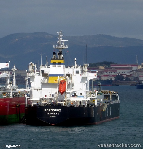
Vessel BOSPOROS IMO: 9315903, MMSI: 538008904 Chemical/Oil Products Tanker
UTC, 38.90663, 26.94633, course: -1, speed: 0
UTC, 38.90661, 26.94619, course: 6, speed: 0
2026-03-05 03:18:33 UTC, 38.90676, 26.94560, course: -1, speed: 0.1
Live Vessel BOSPOROS Analytics (details, animations, etc.)
Live AIS position: UTC. Near Aliaga), updated 2026-03-05 03:18:33 UTC.Find the position of the vessel BOSPOROS on the map. The latter are known coordinates and path.
marine traffic ship tracker show on live map
The current position of vessel BOSPOROS is 38.90676 lat / 26.94560 lng. Updated: 2026-03-05 03:18:33 UTCCurrently sailing under the flag of Marshall Islands
BOSPOROS built in 2007 year
Deadweight:
39589 tDetails:
Last coordinates of the vessel:
UTC, 38.90664, 26.94636, course: -1, speed: 0UTC, 38.90663, 26.94633, course: -1, speed: 0
UTC, 38.90661, 26.94619, course: 6, speed: 0
2026-03-05 03:18:33 UTC, 38.90676, 26.94560, course: -1, speed: 0.1