 vesseltracker.com
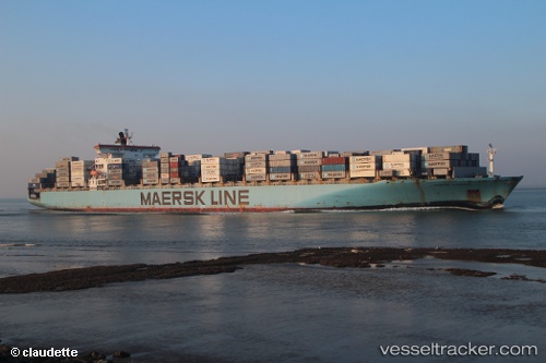
Vessel W KYRENIA IMO: 9211494, MMSI: 538009126 Container Ship
UTC, 22.84333, -17.40500, course: -1, speed: 9
UTC, 23.26104, -17.23850, course: 16, speed: 9.7
2026-03-04 19:48:39 UTC, 23.47299, -17.15867, course: 18, speed: 9.6
Live Vessel W KYRENIA Analytics (details, animations, etc.)
Live AIS position: UTC. 64 nm E of Las Brujas), updated 2026-03-04 19:48:39 UTC.Find the position of the vessel W KYRENIA on the map. The latter are known coordinates and path.
marine traffic ship tracker show on live map
The current position of vessel W KYRENIA is 23.47299 lat / -17.15867 lng. Updated: 2026-03-04 19:48:39 UTCCurrently sailing under the flag of Marshall Islands
W KYRENIA built in 2001 year
Deadweight:
93552 tDetails:
Last coordinates of the vessel:
UTC, 22.45667, -17.57333, course: -1, speed: 16UTC, 22.84333, -17.40500, course: -1, speed: 9
UTC, 23.26104, -17.23850, course: 16, speed: 9.7
2026-03-04 19:48:39 UTC, 23.47299, -17.15867, course: 18, speed: 9.6