 vesseltracker.com
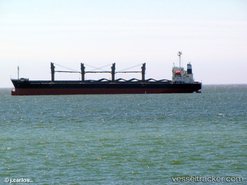
Vessel EVEREST K IMO: 9472696, MMSI: 538009154 Bulk Carrier
UTC, 32.38833, 132.69833, course: -1, speed: 1
UTC, 32.37667, 132.74834, course: -1, speed: 1
2026-03-05 05:18:08 UTC, 32.45667, 132.64500, course: -1, speed: 8
Live Vessel EVEREST K Analytics (details, animations, etc.)
Live AIS position: UTC. 28 nm S of Sukumowan), updated 2026-03-05 05:18:08 UTC.Find the position of the vessel EVEREST K on the map. The latter are known coordinates and path.
marine traffic ship tracker show on live map
The current position of vessel EVEREST K is 32.45667 lat / 132.64500 lng. Updated: 2026-03-05 05:18:08 UTCCurrently sailing under the flag of Marshall Islands
EVEREST K built in 2009 year
Deadweight:
35065 tDetails:
Last coordinates of the vessel:
UTC, 32.42500, 132.78833, course: -1, speed: 8UTC, 32.38833, 132.69833, course: -1, speed: 1
UTC, 32.37667, 132.74834, course: -1, speed: 1
2026-03-05 05:18:08 UTC, 32.45667, 132.64500, course: -1, speed: 8