 vesseltracker.com
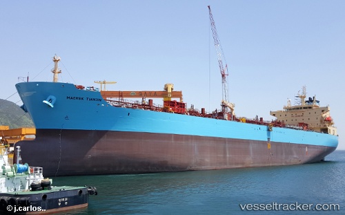
Vessel CL YINGDU IMO: 9718064, MMSI: 538009230 Chemical/Oil Products Tanker
UTC, -22.50333, 164.23833, course: -1, speed: 11
UTC, -21.64157, 163.68958, course: 329, speed: 10.6
2026-03-04 23:47:37 UTC, -21.31877, 163.47960, course: 331, speed: 10
Live Vessel CL YINGDU Analytics (details, animations, etc.)
Live AIS position: UTC. 61 nm SW of Teoudie), updated 2026-03-04 23:47:37 UTC.Find the position of the vessel CL YINGDU on the map. The latter are known coordinates and path.
marine traffic ship tracker show on live map
The current position of vessel CL YINGDU is -21.31877 lat / 163.47960 lng. Updated: 2026-03-04 23:47:37 UTCCurrently sailing under the flag of Marshall Islands
CL YINGDU built in 2016 year
Deadweight:
49722 tDetails:
Last coordinates of the vessel:
UTC, -22.50333, 164.23833, course: -1, speed: 11UTC, -22.50333, 164.23833, course: -1, speed: 11
UTC, -21.64157, 163.68958, course: 329, speed: 10.6
2026-03-04 23:47:37 UTC, -21.31877, 163.47960, course: 331, speed: 10