 vesseltracker.com
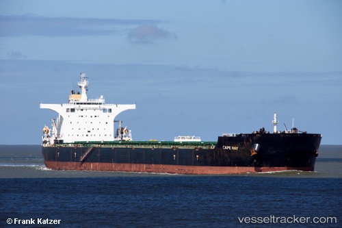
Vessel CAPE RAY IMO: 9405071, MMSI: 538009462 Bulk Carrier
UTC, 28.91667, -29.02667, course: -1, speed: 9
UTC, 28.91667, -29.02667, course: -1, speed: 9
2026-03-04 22:19:18 UTC, 29.36667, -27.99667, course: -1, speed: 9
Live Vessel CAPE RAY Analytics (details, animations, etc.)
Live AIS position: UTC. 54 nm NE of Tarpon Springs), updated 2026-03-04 22:19:18 UTC.Find the position of the vessel CAPE RAY on the map. The latter are known coordinates and path.
marine traffic ship tracker show on live map
The current position of vessel CAPE RAY is 29.36667 lat / -27.99667 lng. Updated: 2026-03-04 22:19:18 UTCCurrently sailing under the flag of Marshall Islands
CAPE RAY built in 2007 year
Deadweight:
177853 tDetails:
Last coordinates of the vessel:
UTC, 28.91667, -29.02667, course: -1, speed: 9UTC, 28.91667, -29.02667, course: -1, speed: 9
UTC, 28.91667, -29.02667, course: -1, speed: 9
2026-03-04 22:19:18 UTC, 29.36667, -27.99667, course: -1, speed: 9