 vesseltracker.com
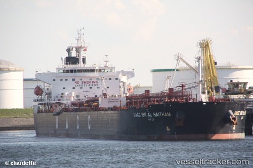
Vessel UOG HARRIET G IMO: 9485631, MMSI: 538009854 Crude Oil Tanker
UTC, -28.20167, 33.74667, course: -1, speed: 11
UTC, -28.20167, 33.74667, course: -1, speed: 11
2026-03-04 20:06:22 UTC, -28.85612, 33.21742, course: -1, speed: 11.5
Live Vessel UOG HARRIET G Analytics (details, animations, etc.)
Live AIS position: UTC. 57 nm E of Richards Bay), updated 2026-03-04 20:06:22 UTC.Find the position of the vessel UOG HARRIET G on the map. The latter are known coordinates and path.
marine traffic ship tracker show on live map
The current position of vessel UOG HARRIET G is -28.85612 lat / 33.21742 lng. Updated: 2026-03-04 20:06:22 UTCCurrently sailing under the flag of Marshall Islands
UOG HARRIET G built in 2009 year
Deadweight:
73338 tDetails:
Last coordinates of the vessel:
UTC, -27.97333, 33.94833, course: -1, speed: 12UTC, -28.20167, 33.74667, course: -1, speed: 11
UTC, -28.20167, 33.74667, course: -1, speed: 11
2026-03-04 20:06:22 UTC, -28.85612, 33.21742, course: -1, speed: 11.5