 vesseltracker.com
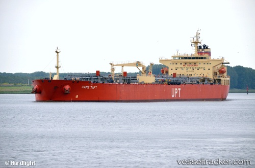
Vessel Cape Taft IMO: 9401221, MMSI: 538090363 Crude Oil Tanker
UTC, 23.19500, -86.57667, course: -1, speed: 10
UTC, 22.60341, -86.14460, course: 148, speed: 11.9
2026-03-04 21:59:17 UTC, 22.23333, -85.89333, course: -1, speed: 12
Live Vessel Cape Taft Analytics (details, animations, etc.)
Live AIS position: UTC. 53 nm NW of Yucatan Channel), updated 2026-03-04 21:59:17 UTC.Find the position of the vessel Cape Taft on the map. The latter are known coordinates and path.
marine traffic ship tracker show on live map
The current position of vessel Cape Taft is 22.23333 lat / -85.89333 lng. Updated: 2026-03-04 21:59:17 UTCDetails:
Last coordinates of the vessel:
UTC, 23.19500, -86.57667, course: -1, speed: 10UTC, 23.19500, -86.57667, course: -1, speed: 10
UTC, 22.60341, -86.14460, course: 148, speed: 11.9
2026-03-04 21:59:17 UTC, 22.23333, -85.89333, course: -1, speed: 12