 vesseltracker.com
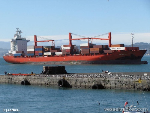
Vessel Alianca Manaus IMO: 9273961, MMSI: 563051900 Container Ship
UTC, 13.00833, 54.97667, course: -1, speed: 8
UTC, 13.92333, 54.76667, course: -1, speed: 8
2026-03-04 23:30:04 UTC, 14.08500, 54.73000, course: -1, speed: 8
Live Vessel Alianca Manaus Analytics (details, animations, etc.)
Live AIS position: UTC. 104 nm NE of Suqutrá), updated 2026-03-04 23:30:04 UTC.Find the position of the vessel Alianca Manaus on the map. The latter are known coordinates and path.
marine traffic ship tracker show on live map
The current position of vessel Alianca Manaus is 14.08500 lat / 54.73000 lng. Updated: 2026-03-04 23:30:04 UTCCurrently sailing under the flag of Singapore
Alianca Manaus built in 2004 year
Deadweight:
33925 tDetails:
Last coordinates of the vessel:
UTC, 13.00833, 54.97667, course: -1, speed: 8UTC, 13.00833, 54.97667, course: -1, speed: 8
UTC, 13.92333, 54.76667, course: -1, speed: 8
2026-03-04 23:30:04 UTC, 14.08500, 54.73000, course: -1, speed: 8