 vesseltracker.com
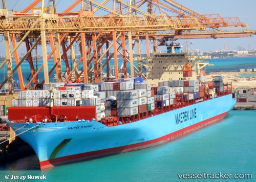
Vessel Maersk Semakau IMO: 9315252, MMSI: 565485000 Container Ship
UTC, -2.55833, 107.22167, course: -1, speed: 12
UTC, -2.55833, 107.22167, course: -1, speed: 12
2026-03-04 21:48:31 UTC, -1.39859, 107.06311, course: -1, speed: 11.6
Live Vessel Maersk Semakau Analytics (details, animations, etc.)
Live AIS position: UTC. 70 nm NE of PANGKAL BALAM), updated 2026-03-04 21:48:31 UTC.Find the position of the vessel Maersk Semakau on the map. The latter are known coordinates and path.
marine traffic ship tracker show on live map
The current position of vessel Maersk Semakau is -1.39859 lat / 107.06311 lng. Updated: 2026-03-04 21:48:31 UTCDetails:
Last coordinates of the vessel:
UTC, -2.62667, 107.22500, course: -1, speed: 12UTC, -2.55833, 107.22167, course: -1, speed: 12
UTC, -2.55833, 107.22167, course: -1, speed: 12
2026-03-04 21:48:31 UTC, -1.39859, 107.06311, course: -1, speed: 11.6