 vesseltracker.com
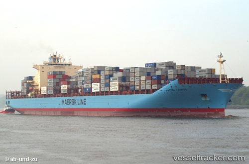
Vessel Maersk Taurus IMO: 9334674, MMSI: 565762000 Container Ship
UTC, 36.57167, -73.93667, course: -1, speed: 1
UTC, 36.58500, -73.89333, course: -1, speed: 0
2026-03-05 03:28:34 UTC, 36.59533, -73.88056, course: 255, speed: 0.5
Live Vessel Maersk Taurus Analytics (details, animations, etc.)
Live AIS position: UTC. 93 nm NE of Nags Head), updated 2026-03-05 03:28:34 UTC.Find the position of the vessel Maersk Taurus on the map. The latter are known coordinates and path.
marine traffic ship tracker show on live map
The current position of vessel Maersk Taurus is 36.59533 lat / -73.88056 lng. Updated: 2026-03-05 03:28:34 UTCDetails:
Last coordinates of the vessel:
UTC, 36.54667, -73.97167, course: -1, speed: 1UTC, 36.57167, -73.93667, course: -1, speed: 1
UTC, 36.58500, -73.89333, course: -1, speed: 0
2026-03-05 03:28:34 UTC, 36.59533, -73.88056, course: 255, speed: 0.5