 vesseltracker.com
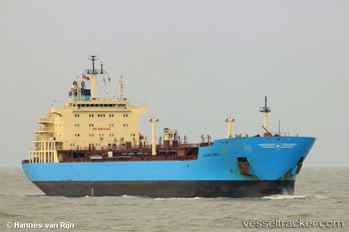
Vessel Maersk Kiera IMO: 9431305, MMSI: 566234000 Chemical Oil Products Tanker
UTC, -23.19084, -44.06539, course: 73, speed: 0.2
UTC, -23.19043, -44.06620, course: 84, speed: 0.4
2026-03-04 23:22:56 UTC, -23.19104, -44.06597, course: 73, speed: 0.2
Live Vessel Maersk Kiera Analytics (details, animations, etc.)
Live AIS position: UTC. 11 nm S of ILHA GUAIBA), updated 2026-03-04 23:22:56 UTC.Find the position of the vessel Maersk Kiera on the map. The latter are known coordinates and path.
marine traffic ship tracker show on live map
The current position of vessel Maersk Kiera is -23.19104 lat / -44.06597 lng. Updated: 2026-03-04 23:22:56 UTCDetails:
Last coordinates of the vessel:
UTC, -23.19075, -44.06544, course: 69, speed: 0.4UTC, -23.19084, -44.06539, course: 73, speed: 0.2
UTC, -23.19043, -44.06620, course: 84, speed: 0.4
2026-03-04 23:22:56 UTC, -23.19104, -44.06597, course: 73, speed: 0.2