 vesseltracker.com
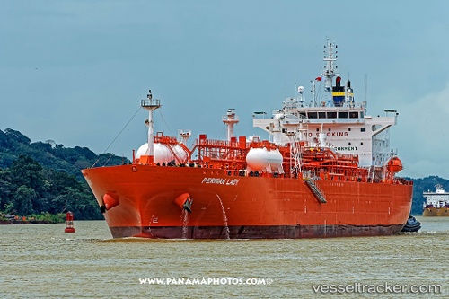
Vessel Permian Lady IMO: 9729269, MMSI: 566506000 Lpg Tanker
UTC, 25.80174, -79.50005, course: 182, speed: 12.6
UTC, 25.24907, -79.51520, course: -1, speed: 13.5
2026-03-04 20:20:30 UTC, 25.17306, -79.52482, course: -1, speed: 13.5
Live Vessel Permian Lady Analytics (details, animations, etc.)
Live AIS position: UTC. 49 nm SE of Fisher Island, Miami), updated 2026-03-04 20:20:30 UTC.Find the position of the vessel Permian Lady on the map. The latter are known coordinates and path.
marine traffic ship tracker show on live map
The current position of vessel Permian Lady is 25.17306 lat / -79.52482 lng. Updated: 2026-03-04 20:20:30 UTCDetails:
Last coordinates of the vessel:
UTC, 26.03287, -79.45355, course: -1, speed: 12.7UTC, 25.80174, -79.50005, course: 182, speed: 12.6
UTC, 25.24907, -79.51520, course: -1, speed: 13.5
2026-03-04 20:20:30 UTC, 25.17306, -79.52482, course: -1, speed: 13.5