 vesseltracker.com
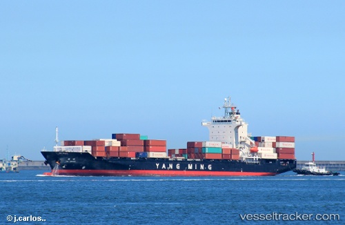
Vessel Ym Image IMO: 9319088, MMSI: 636012796 Container Ship
UTC, 22.39897, 119.64012, course: -1, speed: 17.5
UTC, 20.88108, 118.58703, course: 204, speed: 15.7
2026-03-04 01:31:33 UTC, 20.88108, 118.58703, course: 204, speed: 15.7
Live Vessel Ym Image Analytics (details, animations, etc.)
Live AIS position: UTC. 139 nm SW of Kaohsiung), updated 2026-03-04 01:31:33 UTC.Find the position of the vessel Ym Image on the map. The latter are known coordinates and path.
marine traffic ship tracker show on live map
The current position of vessel Ym Image is 20.88108 lat / 118.58703 lng. Updated: 2026-03-04 01:31:33 UTCCurrently sailing under the flag of Liberia
Ym Image built in 2006 year
Deadweight:
22027 tDetails:
Last coordinates of the vessel:
UTC, 22.39897, 119.64012, course: -1, speed: 17.5UTC, 22.39897, 119.64012, course: -1, speed: 17.5
UTC, 20.88108, 118.58703, course: 204, speed: 15.7
2026-03-04 01:31:33 UTC, 20.88108, 118.58703, course: 204, speed: 15.7