 vesseltracker.com
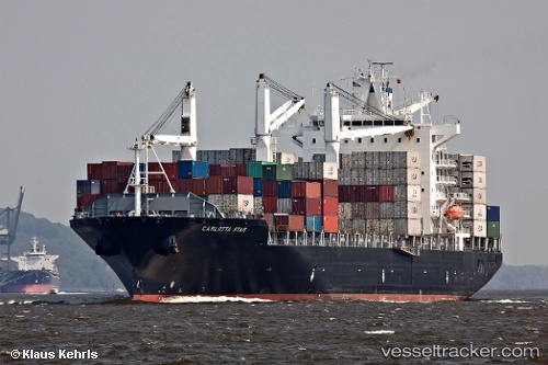
Vessel Carlotta Star IMO: 9210050, MMSI: 636015031 Container Ship
UTC, -32.61104, 161.73795, course: 131, speed: 17
UTC, -32.97929, 162.26302, course: 127, speed: 17
2026-03-04 21:44:03 UTC, -33.25735, 162.67247, course: 128, speed: 16.6
Live Vessel Carlotta Star Analytics (details, animations, etc.)
Live AIS position: UTC. Open sea (no nearby ports in database)), updated 2026-03-04 21:44:03 UTC.Find the position of the vessel Carlotta Star on the map. The latter are known coordinates and path.
marine traffic ship tracker show on live map
The current position of vessel Carlotta Star is -33.25735 lat / 162.67247 lng. Updated: 2026-03-04 21:44:03 UTCCurrently sailing under the flag of Liberia
Carlotta Star built in 2000 year
Deadweight:
40017 tDetails:
Last coordinates of the vessel:
UTC, -32.30470, 161.31291, course: 127, speed: 16.5UTC, -32.61104, 161.73795, course: 131, speed: 17
UTC, -32.97929, 162.26302, course: 127, speed: 17
2026-03-04 21:44:03 UTC, -33.25735, 162.67247, course: 128, speed: 16.6