 vesseltracker.com
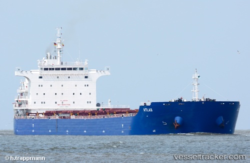
Vessel Atlas IMO: 9642368, MMSI: 636015791 Bulk Carrier
UTC, -35.81833, -12.13333, course: -1, speed: 10
UTC, -35.85036, -11.96332, course: 98, speed: 10.8
2026-03-05 12:11:31 UTC, -35.94846, -11.37110, course: 99, speed: 10.5
Live Vessel Atlas Analytics (details, animations, etc.)
Live AIS position: UTC. 338 nm NW of Ramalde), updated 2026-03-05 12:11:31 UTC.Find the position of the vessel Atlas on the map. The latter are known coordinates and path.
marine traffic ship tracker show on live map
The current position of vessel Atlas is -35.94846 lat / -11.37110 lng. Updated: 2026-03-05 12:11:31 UTCCurrently sailing under the flag of Liberia
Atlas built in 2012 year
Deadweight:
75124 tDetails:
Last coordinates of the vessel:
UTC, -35.73167, -12.64667, course: -1, speed: 10UTC, -35.81833, -12.13333, course: -1, speed: 10
UTC, -35.85036, -11.96332, course: 98, speed: 10.8
2026-03-05 12:11:31 UTC, -35.94846, -11.37110, course: 99, speed: 10.5