 vesseltracker.com
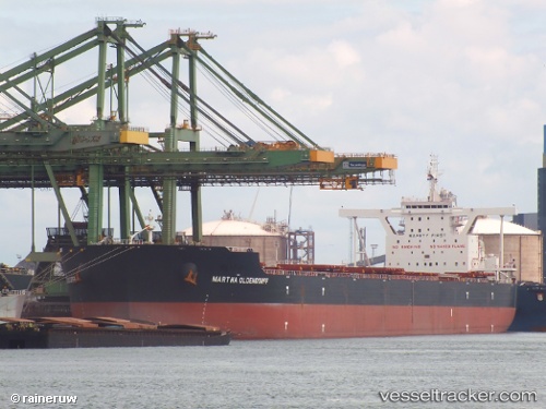
Vessel Martha Oldendorff IMO: 9678812, MMSI: 636016114 Bulk Carrier
UTC, -5.49167, 117.10333, course: -1, speed: 13
UTC, -5.49167, 117.10333, course: -1, speed: 13
2026-03-04 21:45:30 UTC, -4.43934, 117.81117, course: -1, speed: 13.1
Live Vessel Martha Oldendorff Analytics (details, animations, etc.)
Live AIS position: UTC. 101 nm E of Okao), updated 2026-03-04 21:45:30 UTC.Find the position of the vessel Martha Oldendorff on the map. The latter are known coordinates and path.
marine traffic ship tracker show on live map
The current position of vessel Martha Oldendorff is -4.43934 lat / 117.81117 lng. Updated: 2026-03-04 21:45:30 UTCDetails:
Last coordinates of the vessel:
UTC, -5.59500, 117.03333, course: -1, speed: 13UTC, -5.49167, 117.10333, course: -1, speed: 13
UTC, -5.49167, 117.10333, course: -1, speed: 13
2026-03-04 21:45:30 UTC, -4.43934, 117.81117, course: -1, speed: 13.1