 vesseltracker.com
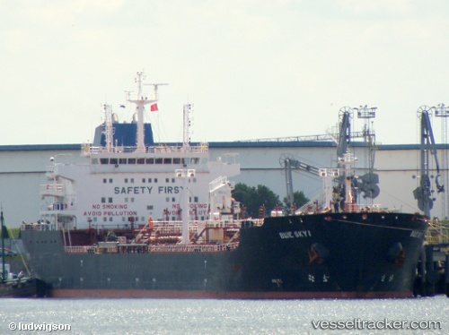
Vessel Blue Sky I IMO: 9335903, MMSI: 636016728 Chemical Oil Products Tanker
UTC, 5.99056, 94.42786, course: -1, speed: 11.8
UTC, 5.98926, 94.17755, course: -1, speed: 12.6
2026-03-05 05:46:08 UTC, 5.96957, 93.79209, course: -1, speed: 11.1
Live Vessel Blue Sky I Analytics (details, animations, etc.)
Live AIS position: UTC. 91 nm W of Sebang), updated 2026-03-05 05:46:08 UTC.Find the position of the vessel Blue Sky I on the map. The latter are known coordinates and path.
marine traffic ship tracker show on live map
The current position of vessel Blue Sky I is 5.96957 lat / 93.79209 lng. Updated: 2026-03-05 05:46:08 UTCCurrently sailing under the flag of Liberia
Blue Sky I built in 2006 year
Deadweight:
38402 tDetails:
Last coordinates of the vessel:
UTC, 6.01321, 95.04324, course: -1, speed: 11UTC, 5.99056, 94.42786, course: -1, speed: 11.8
UTC, 5.98926, 94.17755, course: -1, speed: 12.6
2026-03-05 05:46:08 UTC, 5.96957, 93.79209, course: -1, speed: 11.1