 vesseltracker.com
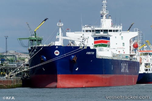
Vessel Anikitos IMO: 9710490, MMSI: 636016949 Chemical Oil Products Tanker
UTC, 20.76372, -109.01937, course: 318, speed: 13.3
UTC, 21.00729, -109.29982, course: 314, speed: 13.1
2026-03-05 06:12:41 UTC, 21.34065, -109.68887, course: 310, speed: 13.1
Live Vessel Anikitos Analytics (details, animations, etc.)
Live AIS position: UTC. 92 nm S of Los Cabos), updated 2026-03-05 06:12:41 UTC.Find the position of the vessel Anikitos on the map. The latter are known coordinates and path.
marine traffic ship tracker show on live map
The current position of vessel Anikitos is 21.34065 lat / -109.68887 lng. Updated: 2026-03-05 06:12:41 UTCDetails:
Last coordinates of the vessel:
UTC, 20.43138, -108.63290, course: 315, speed: 13UTC, 20.76372, -109.01937, course: 318, speed: 13.3
UTC, 21.00729, -109.29982, course: 314, speed: 13.1
2026-03-05 06:12:41 UTC, 21.34065, -109.68887, course: 310, speed: 13.1