 vesseltracker.com
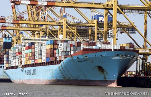
Vessel Maersk Kotka IMO: 9085534, MMSI: 636018933 Container Ship
UTC, 51.29869, 4.26443, course: 31, speed: 0.1
UTC, 51.29883, 4.26471, course: 31, speed: 0.1
2026-03-04 22:22:36 UTC, 51.29874, 4.26452, course: 32, speed: 0.1
Live Vessel Maersk Kotka Analytics (details, animations, etc.)
Live AIS position: UTC. Near Doel), updated 2026-03-04 22:22:36 UTC.Find the position of the vessel Maersk Kotka on the map. The latter are known coordinates and path.
marine traffic ship tracker show on live map
The current position of vessel Maersk Kotka is 51.29874 lat / 4.26452 lng. Updated: 2026-03-04 22:22:36 UTCCurrently sailing under the flag of Liberia
Maersk Kotka built in 1996 year
Deadweight:
84900 tDetails:
Last coordinates of the vessel:
UTC, 51.29879, 4.26454, course: 31, speed: 0.1UTC, 51.29869, 4.26443, course: 31, speed: 0.1
UTC, 51.29883, 4.26471, course: 31, speed: 0.1
2026-03-04 22:22:36 UTC, 51.29874, 4.26452, course: 32, speed: 0.1