 vesseltracker.com
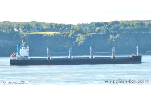
Vessel CURACAO IMO: 9426142, MMSI: 636019657 Bulk Carrier
UTC, 35.84390, -30.96368, course: 89, speed: 10.2
UTC, 35.84318, -30.72070, course: -1, speed: 9.9
2026-03-04 17:15:12 UTC, 35.84318, -30.72070, course: -1, speed: 9.9
Live Vessel CURACAO Analytics (details, animations, etc.)
Live AIS position: UTC. 189 nm SW of Capelo), updated 2026-03-04 17:15:12 UTC.Find the position of the vessel CURACAO on the map. The latter are known coordinates and path.
marine traffic ship tracker show on live map
The current position of vessel CURACAO is 35.84318 lat / -30.72070 lng. Updated: 2026-03-04 17:15:12 UTCCurrently sailing under the flag of Liberia
CURACAO built in 2011 year
Deadweight:
57937 tDetails:
Last coordinates of the vessel:
UTC, 35.85167, -31.36500, course: -1, speed: 10UTC, 35.84390, -30.96368, course: 89, speed: 10.2
UTC, 35.84318, -30.72070, course: -1, speed: 9.9
2026-03-04 17:15:12 UTC, 35.84318, -30.72070, course: -1, speed: 9.9