 vesseltracker.com
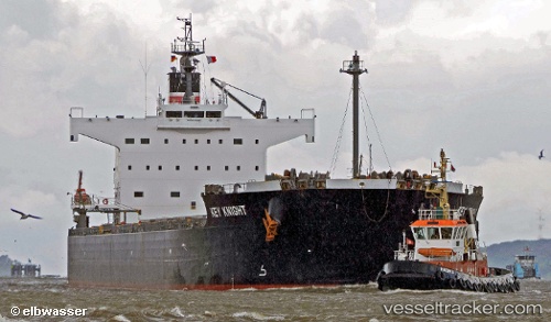
Vessel KEY KNIGHT IMO: 9512317, MMSI: 636020651 Bulk Carrier
UTC, 34.37667, 133.84332, course: -1, speed: 7
UTC, 34.37667, 133.84332, course: -1, speed: 7
2026-03-06 01:14:54 UTC, 34.37667, 133.84332, course: -1, speed: 7
Live Vessel KEY KNIGHT Analytics (details, animations, etc.)
Live AIS position: UTC. Near Sakaide), updated 2026-03-06 01:14:54 UTC.Find the position of the vessel KEY KNIGHT on the map. The latter are known coordinates and path.
marine traffic ship tracker show on live map
The current position of vessel KEY KNIGHT is 34.37667 lat / 133.84332 lng. Updated: 2026-03-06 01:14:54 UTCCurrently sailing under the flag of Liberia
KEY KNIGHT built in 2012 year
Deadweight:
82099 tDetails:
Last coordinates of the vessel:
UTC, 34.42167, 134.17667, course: -1, speed: 12UTC, 34.37667, 133.84332, course: -1, speed: 7
UTC, 34.37667, 133.84332, course: -1, speed: 7
2026-03-06 01:14:54 UTC, 34.37667, 133.84332, course: -1, speed: 7