 vesseltracker.com
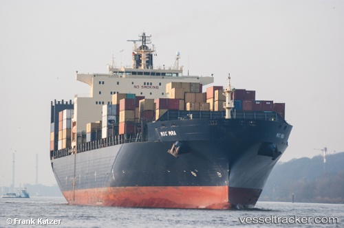
Vessel GSL MYNY IMO: 9213583, MMSI: 636020773 Container Ship
UTC, 50.24771, 173.13828, course: 93, speed: 19.1
UTC, 50.19581, 174.27792, course: 91, speed: 19.6
2026-03-05 09:49:39 UTC, 50.15188, 175.08276, course: 95, speed: 20.3
Live Vessel GSL MYNY Analytics (details, animations, etc.)
Live AIS position: UTC. 94 nm N of Trebatice), updated 2026-03-05 09:49:39 UTC.Find the position of the vessel GSL MYNY on the map. The latter are known coordinates and path.
marine traffic ship tracker show on live map
The current position of vessel GSL MYNY is 50.15188 lat / 175.08276 lng. Updated: 2026-03-05 09:49:39 UTCCurrently sailing under the flag of Liberia
GSL MYNY built in 2000 year
Deadweight:
67564 tDetails:
Last coordinates of the vessel:
UTC, 50.30125, 171.94072, course: 92, speed: 19.6UTC, 50.24771, 173.13828, course: 93, speed: 19.1
UTC, 50.19581, 174.27792, course: 91, speed: 19.6
2026-03-05 09:49:39 UTC, 50.15188, 175.08276, course: 95, speed: 20.3