 vesseltracker.com
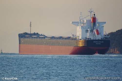
Vessel AEOLIAN IMO: 9580209, MMSI: 636020935 Bulk Carrier
UTC, 50.21496, -149.97183, course: 88, speed: 12.1
UTC, 50.21252, -149.19165, course: 94, speed: 12.3
2026-03-05 10:23:37 UTC, 50.19092, -148.50029, course: 94, speed: 12.1
Live Vessel AEOLIAN Analytics (details, animations, etc.)
Live AIS position: UTC. 100 nm SE of Drinagh), updated 2026-03-05 10:23:37 UTC.Find the position of the vessel AEOLIAN on the map. The latter are known coordinates and path.
marine traffic ship tracker show on live map
The current position of vessel AEOLIAN is 50.19092 lat / -148.50029 lng. Updated: 2026-03-05 10:23:37 UTCCurrently sailing under the flag of Liberia
AEOLIAN built in 2012 year
Deadweight:
83478 tDetails:
Last coordinates of the vessel:
UTC, 50.24691, -150.40582, course: 89, speed: 12.3UTC, 50.21496, -149.97183, course: 88, speed: 12.1
UTC, 50.21252, -149.19165, course: 94, speed: 12.3
2026-03-05 10:23:37 UTC, 50.19092, -148.50029, course: 94, speed: 12.1